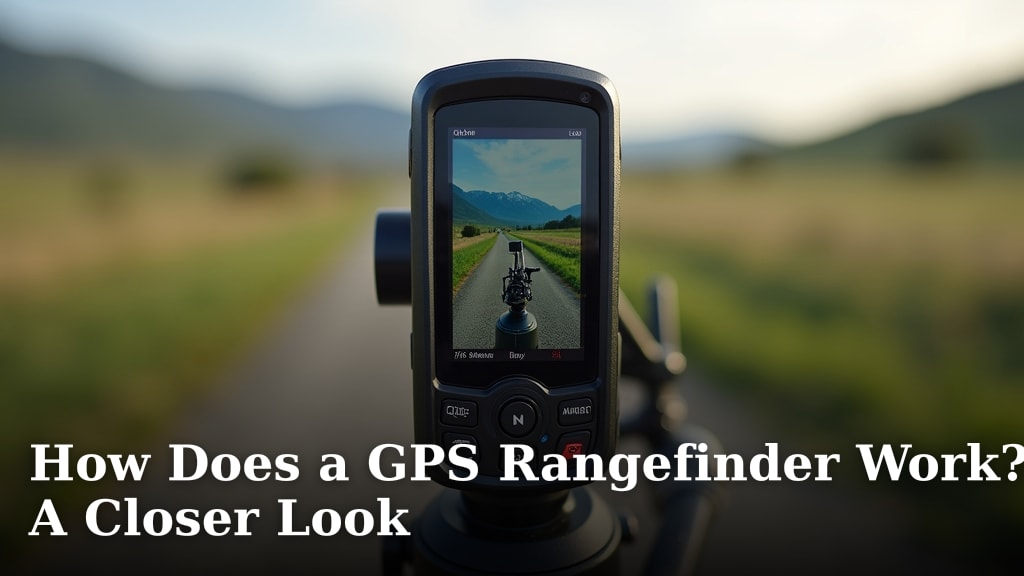
How Does a GPS Rangefinder Work? A Closer Look
A GPS rangefinder works by using global positioning system (GPS) technology to calculate your distance from targets on a golf course or hunting field. It receives signals from satellites to determine your precise location. Then, it compares your location to stored data of course features or pre-mapped hunting spots to give you accurate distance readings. You get reliable measurements without needing direct line-of-sight like traditional laser rangefinders.
Think of it as your personal cartographer, but for finding distances. Unlike lasers that bounce off objects, GPS relies on knowing where you are on Earth. This means it’s less affected by weather conditions like fog or rain. It can also provide distances to hazards, fairways, and the pin, offering more information than just point-to-point measurements.
- GPS rangefinders use satellite signals.
- They calculate your position and compare it to map data.
- This provides accurate distances to targets on the course or in the field.
- They work well in various weather conditions.
- They can offer distances to multiple points, not just one target.
Let’s dive deeper and see exactly how this clever technology gives you the distances you need.
Here is the main body content for your blog post:Understanding How GPS Rangefinders Get Their Bearings
So, you’re curious about how those little gadgets tell you exactly how far that flag is, or how far that treeline is from your hunting blind? It’s all about satellites. Unlike a laser rangefinder that bounces a beam off an object, a GPS rangefinder works by figuring out precisely where you are on the planet. It then uses that information, combined with pre-loaded maps, to tell you distances.
The Role of Satellites in Pinpointing Your Location
At its core, a GPS rangefinder taps into the Global Positioning System. You might know this system by its common name, GPS. It’s a network of satellites orbiting the Earth. These satellites are constantly broadcasting signals. Your rangefinder has a receiver that picks up these signals. It needs to “see” at least four satellites to get a good fix on your position. The device measures the time it takes for the signals to arrive from each satellite. This timing helps it calculate your exact latitude, longitude, and altitude.
How Signal Timing Translates to Location
Think of it like this: if you know how far away three known points are, you can figure out where you are. GPS does something similar, but with satellites. Each satellite sends out a signal with its precise location and the exact time the signal was sent. Your receiver notes the time it receives the signal. The difference in time tells the receiver how far away that satellite is. By doing this with multiple satellites, the receiver can triangulate your position on Earth. It’s a pretty clever bit of science that happens almost instantly.
The Importance of Pre-Loaded Course or Area Maps
Knowing your location is only half the battle. To give you distances to specific points on a golf course or in a hunting area, the rangefinder needs to know what’s there. This is where pre-loaded maps come in. Manufacturers create detailed maps of golf courses worldwide, or sometimes, specific hunting regions. These maps contain information about the location of the green, hazards like bunkers and water, and sometimes even tee boxes. For hunting devices, these maps might show landmarks, property lines, or known features of the terrain.
How Your Location Compares to Map Data
Once your rangefinder knows your exact coordinates, it overlays that position onto the stored map data. Let’s say you’re on the 150-yard marker on a golf course. Your rangefinder knows where that marker is on its internal map. It also knows the location of the center of the green or the front of the green. By calculating the straight-line distance between your current coordinates and the coordinates of the target on the map, it can display that distance to you. It’s a bit like plotting a dot on a digital map and then measuring the distance to another dot.
Keeping Your Maps Up-to-Date
Golf courses change. New hazards might appear, or greens might be reshaped. Hunting areas can also see changes. That’s why it’s important to keep your rangefinder’s maps updated. Most GPS rangefinders allow you to connect them to a computer or an app to download the latest course updates. Some devices might even offer automatic updates when connected to Wi-Fi. This ensures the distances you’re getting are as accurate as possible. Checking for updates periodically can prevent surprising distances on the course or in the field.
What Makes GPS Rangefinders Different?
You might be wondering how this method stacks up against other distance-measuring tools, especially laser rangefinders. While both aim to give you accurate yardage, their underlying technology and capabilities differ. Understanding these differences helps you choose the right tool for your needs.
GPS vs. Laser: A Fundamental Difference
The core difference lies in how they measure distance. A laser rangefinder shoots a laser beam at your target. It then times how long it takes for the light to bounce back. This gives you a direct distance to that specific object. It requires a clear line of sight to what you’re aiming at. A GPS rangefinder, on the other hand, relies on your position relative to mapped features. It doesn’t need to aim at anything; it just needs to know where you are and where the target is on its map.
Accuracy and Line-of-Sight Considerations
Laser rangefinders can be incredibly accurate for pinpointing a specific spot, like the flagstick. However, they struggle with fog, heavy rain, or thick brush that obstructs the view. They also can’t easily give you distances to things you can’t see, like the front edge of a water hazard hidden behind a ridge. GPS rangefinders are generally accurate to within a few yards, which is more than enough for most golf or hunting scenarios. They are less affected by weather because they don’t rely on line-of-sight measurements. You can get distances to hazards or hazards around a bend, for example.
Advantages of GPS in Different Scenarios
Because they use satellite data and maps, GPS rangefinders offer a broader picture. They often come pre-loaded with thousands of golf courses, saving you the trouble of manually mapping them. They can also display distances to multiple points on a hole, such as the front, middle, and back of the green, or the distances to fairway bunkers. This comprehensive information helps you make smarter decisions about club selection or hunting strategies. For golfers, this means you’re not just measuring to the pin but also understanding the risks and rewards around the green.
Weather Resistance and Usability
One of the big wins for GPS rangefinders is their performance in less-than-ideal weather. Rain, fog, or even snow won’t stop your GPS unit from calculating your position. This makes them a reliable tool for those days when you might otherwise have to guess. If you play golf in a region with unpredictable weather, or hunt during seasons known for fog, this feature is a significant advantage. You can trust your device to keep working when you need it most.
The Practical Benefits for You
So, what does all this mean for your game or your hunt? It means fewer surprises and more confidence. You spend less time fiddling with a device and more time focusing on your shot or your strategy. Knowing precise distances to multiple points on a hole can help you avoid costly mistakes. In hunting, having a clear understanding of your distance to potential targets and your surroundings can make for a more successful and ethical outing. It’s about having reliable data at your fingertips.
A Quick Checklist for GPS Rangefinder Functionality:
- Receives signals from multiple satellites.
- Calculates your precise geographic coordinates.
- Uses stored maps to identify course or area features.
- Measures the distance between your position and mapped targets.
- Updates can be downloaded for current course/area data.
- Offers distances to multiple points (e.g., front/middle/back of green).
Conclusion
You now understand how your GPS rangefinder uses satellites and stored maps to give you accurate distances. It’s a reliable tool that works even when weather conditions make lasers struggle. By knowing your location relative to course features, you can make smarter decisions on the fairway or in the field. To make the most of this technology, remember to keep your device’s maps updated. This ensures you always have the most current information for confident play or hunting.
Frequently Asked Questions
How accurate are GPS rangefinders compared to laser rangefinders?
GPS rangefinders are generally accurate to within a few yards, which is sufficient for most golf and hunting needs. Laser rangefinders can offer pinpoint accuracy to a specific object but rely on a clear line of sight. GPS is less affected by weather and obstructions.
Do I need a phone or internet connection for my GPS rangefinder to work?
No, you do not need a phone or internet connection for your GPS rangefinder to function. Once the maps are loaded, it works by receiving signals directly from satellites to determine your location.
Can a GPS rangefinder measure distances to things like water hazards or bunkers?
Yes, that’s one of the strengths of a GPS rangefinder. It uses pre-loaded maps that include the location of hazards like water, sand traps, and other course features. It can provide distances to these points even if they are not directly visible.
What happens if the satellites are blocked by trees or buildings?
While dense overhead cover like thick trees or tall buildings can sometimes temporarily reduce accuracy, GPS rangefinders are designed to maintain a signal. They often pick up signals from multiple satellites, helping to maintain a reliable fix on your position.
How often should I update the maps on my GPS rangefinder?
It’s a good practice to check for map updates periodically, especially before a golf season starts or if you play a new course. Most manufacturers recommend checking for updates every few months or when new course layouts are released to ensure the most accurate distance readings.